Mapping Broadband Services and Speeds
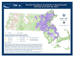
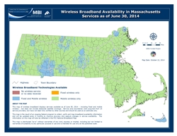
As part of a national program called the State Broadband Initiative (SBI), the MBI collected and mapped broadband services available across the state by provider, transmission technology, and speed. Data and maps were updated twice a year from 2010 to 2014.
- Visit the FCC website to view and explore the most current broadband deployment maps and data
- Check out the June 2014 maps below or find more wireline and wireless technology maps in our Map Gallery
- View the Massachusetts broadband provider list from April 2014
SBI Program Reports
- Final Project Report
- Quarterly Progress Reports
- Semi-annual Broadband Data Collection and Mapping Reports
- Regional Planning Agency report on Wireless Broadband Zoning Bylaws (December 2012)
NTIA Briefs on Broadband Availability
- U.S. Broadband Availability: June 2010 - June 2012 (May 2013)
- Broadband Availability Beyond the Rural/Urban Divide (June 2013)
- Broadband Availability in the Workplace (November 2013)


