
Massachusetts Broadband Serviceable Location Data
In October 2022, MBI completed development of the first statewide Broadband Serviceable Location (BSL) dataset to support broadband mapping and analysis in Massachusetts. BSLs are locations where wired (e.g., cable or fiber) or fixed wireless broadband service can or has been installed.
The BSL data consists of unique records for each address point and the associated address. Each point is located on the largest, most complex building (identified as the primary building) and the associated address record contains unit counts for locations that have more than one unit.
The BSL data is derived from the state Master Address Database (MAD) maintained by MassGIS and the City of Boston’s Street Address Management (SAM) data and will continue to be updated and improved. The MAD is Next Generation 911 (NG911) street address data maintained by through a joint agreement with State 9-1-1 and partnerships with all MA cities and towns.
The BSL data is available in ESRI file geodatabase (.gdb) and comma delimited (.csv) formats. A file with field descriptions is included with each download.
- Download in GDB & CSV format (188 MB)
- Download in GDB format only (110 MB)
- Download in CSV format only (78 MB)
Last Mile Program Maps
Maps related to the MBI's Last Mile programs for "unserved" and "underserved" towns in the MassBroadband 123 network footprint. "Unserved" towns do not have cable, fiber-optic, or other internet services that meet the FCC minimum requirement speeds of 25 Mbps downstream & 3 Mbps upstream. "Underserved" towns have cable broadband services with less than 96% cable penetration rates.
The Commonwealth’s Last Mile program is connecting unserved and underserved municipalities in Western and Central Massachusetts to 21st-century high-speed internet. Of the 53 Last Mile communities, 48 towns have completed projects and an additional 5 municipalities have some premises lit but are not fully complete.
View Map Archives for maps and data from previous years.
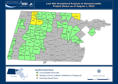
Last Mile Broadband Projects: Project Status, August 1, 2023 (310 KB)
Map representing the status of last mile broadband projects. Towns in the MassBroadband123 service area that were considered "unserved" and "underserved" by broadband qualified for last mile broadband funding support from the Commonwealth. The map differentiates towns according to four categories: (1) towns with fully complete and operational networks, (2) towns with partially operational networks that are still in construction, (3) remaining last mile towns to be completed, and (4) previously served towns not included in the program.
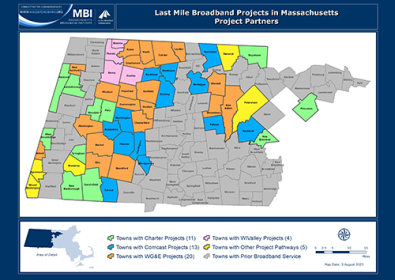
Last Mile Broadband Projects: Project Partners, August 1, 2023 (310 KB)
Map of project partners and pathways chosen to construct broadband networks in last mile program towns. Towns in the MassBroadband123 service area that were considered "unserved" and "underserved" by broadband qualified for last mile broadband funding support from the Commonwealth.
MassBroadband 123 Network Maps
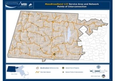
Maps depicting the MassBroadband 123 service area and network design. The MassBroadband 123 project consists of over 1,200 miles of fiber to connect over 120 unserved and underserved communities in western and north central Massachusetts.
Network and Points of Interconnection, January 22, 2014 (5 MB)
Map of the MassBroadband 123 service area and network, including the location of fiber-optic cables and points of interconnection. MassBroadband 123 network construction and testing was completed and turned over to the MBI’s network operator in January 2014.
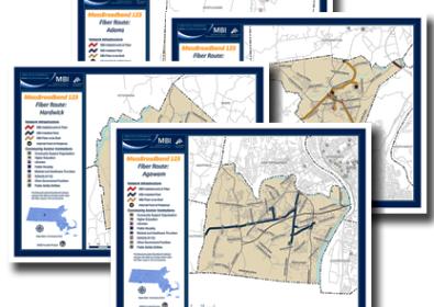
Network by Community, January 22, 2014 (1 MB)
Select a town from the list below to view a map that shows the location of MassBroadband 123 fiber and community anchor institutions (CAI) that were connected in that community as of the completion of the project in January 2014.
National Broadband Maps & Data
Link to national broadband maps and data maintained by the Federal Communications Commission (FCC) and National Telecommunications & Information Administration (NTIA).
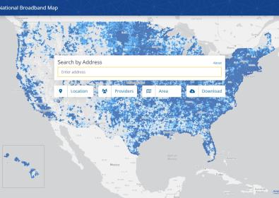
FCC National Broadband Map
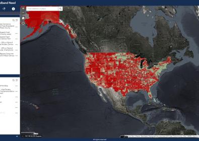
NTIA Broadband Indicators of Need Map
Contact
For any questions, contact broadband@masstech.org